Reading a Plan Sheet's Stationing
Every number on a highway plan traces back to one stationed line. Once you can read it, the whole plan sheet stops being a puzzle.
September 1, 2026 · 4 min read
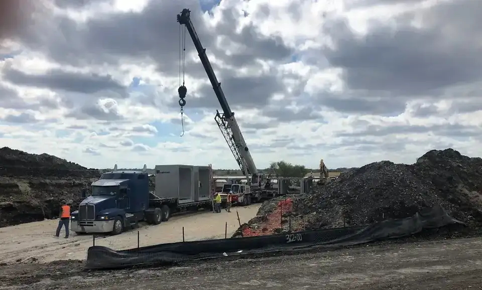
Walk any active stretch of highway work and you'll see a number stenciled on a silt fence, spray-painted on the ground, or written on a stake: something like 312+00. To a driver passing by it means nothing. To the crew, it's the single reference point that everything else on that job gets measured from.
What the number actually means
A station like 312+00 is a distance along the project's centerline, measured in feet from a fixed starting point, usually station 0+00 wherever the design begins. The number reads as hundreds of feet plus the remainder: 312+00 means 31,200 feet from that starting point. If you saw 312+50 written a little further down the fence line, that's 50 feet past 312+00, and the crew reads it exactly like a tape measure that never gets picked up and moved, just laid out once for the whole length of the job and referenced from then on.
That's the whole idea behind stationing. Instead of every drawing, every stake, and every conversation on site using its own local description, distances get anchored to one continuous line that runs the length of the project. "About halfway down past the culvert" isn't a location anybody can build from. "312+00" is exact, and it's exact on every sheet in the plan set, from the grading plan to the drainage plan to the utility plan, because they're all stationed off the same centerline.
Why the centerline carries the whole plan
The centerline itself usually follows the middle of the roadway design, and it's the one line every other measurement on the plan set relates back to. Grade elevations are called out at specific stations along it. Drainage structures, culverts, inlets, are located by the station where they cross or tie into the roadway. Utility conflicts get flagged by station so a crew knows exactly where along the run to expect a gas line or a fiber conduit before they ever put a shovel in the ground. None of that works without a single stationed reference everyone on the job, and every discipline involved in designing it, is reading off the same way.
Offsets: how far from the line, not just how far along it
Stationing alone only tells you distance along the centerline. The other half of locating anything on a plan sheet is the offset, how far to the left or right of that centerline a feature sits, usually called out in feet, left or right, from a given station. A note reading something like "25' LT at STA 312+00" tells a crew exactly where to find a structure or a grade break: go to station 312+00 along the centerline, then measure 25 feet to the left of it. Between a station and an offset, any point on the entire project can be pinned down with two numbers, which is the whole reason the system exists in the first place.
How grade gets called from stationing
Roadway grade, meaning the elevation of the finished pavement, is set at specific stations along the profile and interpolated between them. A grading crew working a stretch of roadway isn't guessing at elevation by eye. They're reading the design elevation called out at the nearest stations, checking their own survey shots against it, and building the subgrade and base to hit that elevation at every point along the run. Stationing is what lets a plan sheet call out an elevation at 312+00 and a different elevation at 315+00 and have every foot in between make sense as a smooth, buildable grade instead of two disconnected numbers.
Why the whole crew works from it
- Survey crews stake stations and offsets on the ground so equipment operators and hand crews know exactly where a feature belongs before it's built
- Grading crews build subgrade and base to the elevations called out at each station along the profile
- Drainage and utility crews locate culverts, inlets, and conflicts by the station and offset where they cross the roadway design
- Inspectors and estimators reference the same stationing when they're checking quantities or progress against the plan, so "the work done between 300+00 and 312+00" means the same thing to everyone reading it
That's why a number like 312+00 ends up stenciled on a silt fence instead of just printed on a drawing back in a trailer. It's not decoration and it's not paperwork. It's the address every part of the job gets built against, from the survey stake in the ground to the grade the finished road actually holds. Once you can read a station and an offset, a plan sheet stops looking like a wall of lines and numbers and starts reading as exactly what it is: a set of precise instructions for where everything on a highway goes.
Aaron Concrete Contractors, (512) 926-7326
Call (512) 926-7326More articles
What Clean Concrete Actually Means at a Recycling Scale
Clean concrete makes good base material. Dirty concrete makes a pile nobody can sell, so the scale house asks the same three questions every time.
Slip Form Barrier vs. Precast Barrier: How the Choice Actually Gets Made
Neither barrier type is better. They solve different problems, and the job in front of you usually answers the question before anyone has to argue about it.